I had a meeting with a client in College Station, TX booked for this week and flew down myself. It was (by far) the longest flights I’ve done and this post describes some of the experience.
How far is that?
Very. Here’s what the direct route looks like thanks to GC Map: 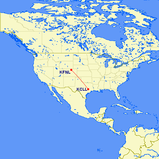
For any Irish readers, it looks a lot more impressive! This is the same distance using Enniskillen (EGAB) as the starting airport 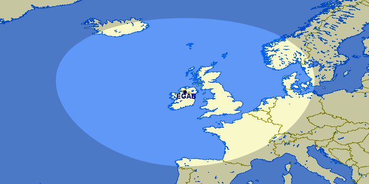
It brings home the size of the US, and the size of Texas particularly.
Weather
In Northern Colorado we’ve been having a spell of very hot weather - at the time of writing, we’ve had three consecutive days with 100°F+ temperatures. This tends to cause buildups in the afternoon but the mornings are glorious. I studied Aviation Weather, particularly the Prog charts and concluded that leaving very early on Monday morning would be good.
The trip
I planned for a stop-off on the way there and on the way back; I think it is possible to do it in a single hop but it would require an economical engine/prop configuration which would lead to a very long flight time.
Leg 1: KFNL-KCDS
I set off from Fort Collins early on the morning of June 14th - I think I was airborne at 5:15am which is approximately 15 mins before sunrise. On the subject of sunrises, it was glorious - I was not cleared into Denver’s Class Bravo airspace so was skirting around the eastern side of Denver which meant I had a perfect view of the sunrise. The air was relatively cool and perfectly still. The METAR from around then was:
KFNL 141156Z 34006KT 10SM CLR 15/12 A3020
I had requested VFR flight following immediately after I departed the KFNL area; to the east of Denver, I was cleared to start my climb up to my desired cruise altitude of 11,500’ through the last part of the Class Bravo. Once level at 11,500’ I brought the MP and prop settings back to a little under 70% power; this was giving me betwen 139 and 141 KTAS. I was keeping an eye on a fairly big weather pattern which was hanging over the Texas panhandle; as I entered Texas, this was what awaited me:
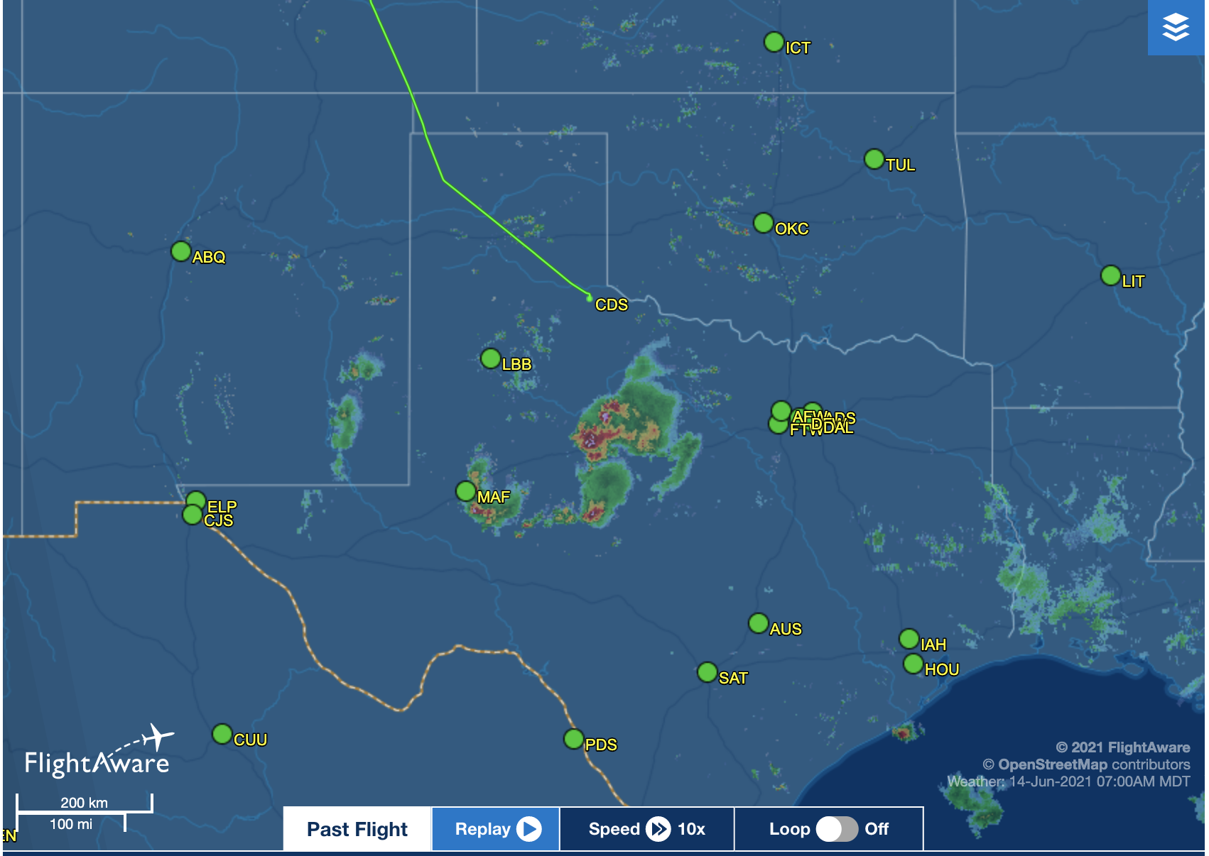
The airport I had picked as my destination was KPVW (Hale County in Plainview, TX); however, as I looked at the weather both onboard on the G1000 as well as on Foreflight on the iPad I started to realize that going to Plainview would put me on the west of the storm and I needed to continue on to the east of it. So, not long after I crossed into Texas I looked for suitable airports much more to the east and not so far south; I settled on KCDS (Childress, TX) and notified ATC of my revised intentions. On the subject of ATC they were excellent on all four legs of this trip, particularly in helping me to transition a number of MOAs.
I landed at a deserted Childress airfield and topped up on gas - although it was only 10am CDT it was already very hot; after filling up, I did my checks and departed without hanging around!
Leg 2: KCDS-CLL
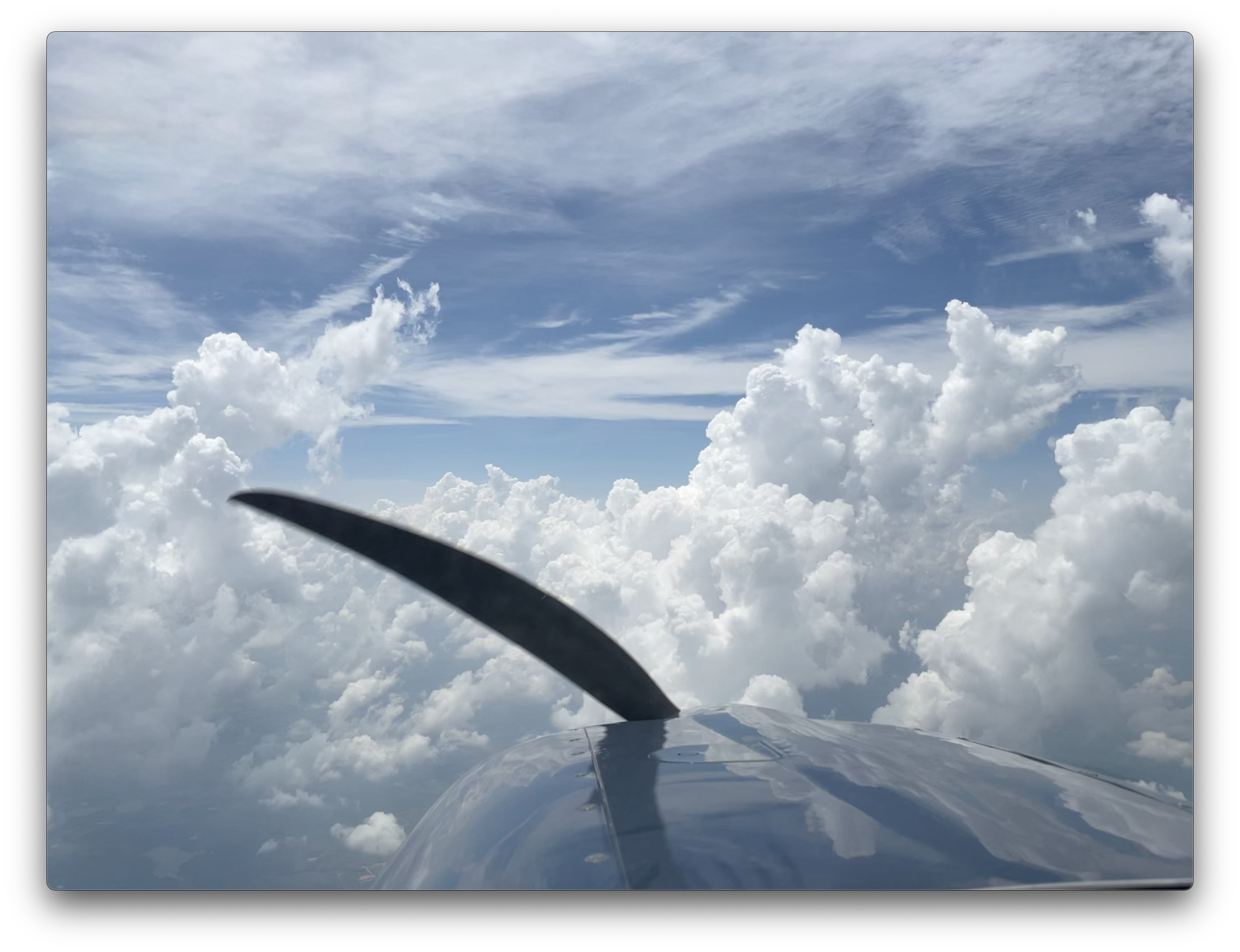
This was the most interesting leg of the entire trip; firstly, I couldn’t proceed on course because the weather system was directly in my way - I had to go east until I got near Wichita Falls before I was able to turn south.
I know that image makes it look like I avoided the weather by 100 miles but there was a lot cloud that wasn’t showing on the ADSB feed; this photo shows how beautiful it was:
Once I’d got past the north-east corner of the weather system I was able to turn on course to College Station. The airspace got much busier as I progressed into central Texas and I flew over a fairly constant set of small clouds - but it was still perfectly smooth and relatively cool at altitude. As I got closer to my destination, I started a gradual descent with some very minor deviations to avoid small clouds. However, with each 1,000’ of descent it got hotter and hotter. Here’s the METAR for College Station from the time I landed:
KCLL 141953Z 04005KT 10SM FEW050 SCT080 36/24 A2993
36°C (97°F)!! Even after I landed and opened the window all I got was scorching hot air blasting past – I could feel the humidity like a blanket. I parked up at Astin Aviation and got an Uber to my hotel; when I got there I recorded a video with some immediate thoughts on the journey:
The journey back
I’ll write this up in a separate post in the coming days….